The Pontax Project is a greenfield lithium pegmatite exploration play located in the James Bay region of Quebec, Canada. Pontax hosts the largest and most intense spodumene-in-till anomaly within Li-FT's Quebec portfolio. The project is road-accessible via the Billy Diamond Highway and is near existing rail infrastructure.
Property Size: 52,593 hectares
Target: Lithium-cesium-tantalum (LCT) pegmatite dykes, interpreted to be the source of a 25 km x 10 km spodumene grain anomaly in glacial till
Exploration Stage: High-tenor spodumene-bearing till anomaly defined from 336 samples across a 25 km strike length; three prospective pegmatite corridors identified (A, B, and C)
Next Steps: 5,000-metre maiden diamond drill program completed April 2025
Geological Prospectivity Indicators: Structural contact between amphibolite and metasedimentary rocks, presence of LCT vector minerals: holmquistite, garnet, apatite, and beryl, geologic setting within the lower Eastmain greenstone belt (La Grande Subprovince), pegmatitic granites and outcrops with complex LCT mineralogy.
Exploration Maturity: Extensive till and surface sampling completed in 2023-2024, maiden drill program completed and fully designed based on integrated till, outcrop, and structural datasets.
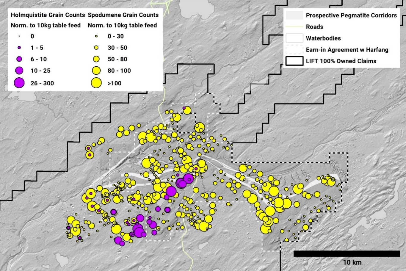
Figure 1 – Pontax Project spodumene and holmquistite grain counts from till samples collected in 2023 and 2024 at LIFT’s Pontax Project. (Holmquistite is a lithium-bearing amphibole commonly associated with spodumene-bearing dykes).
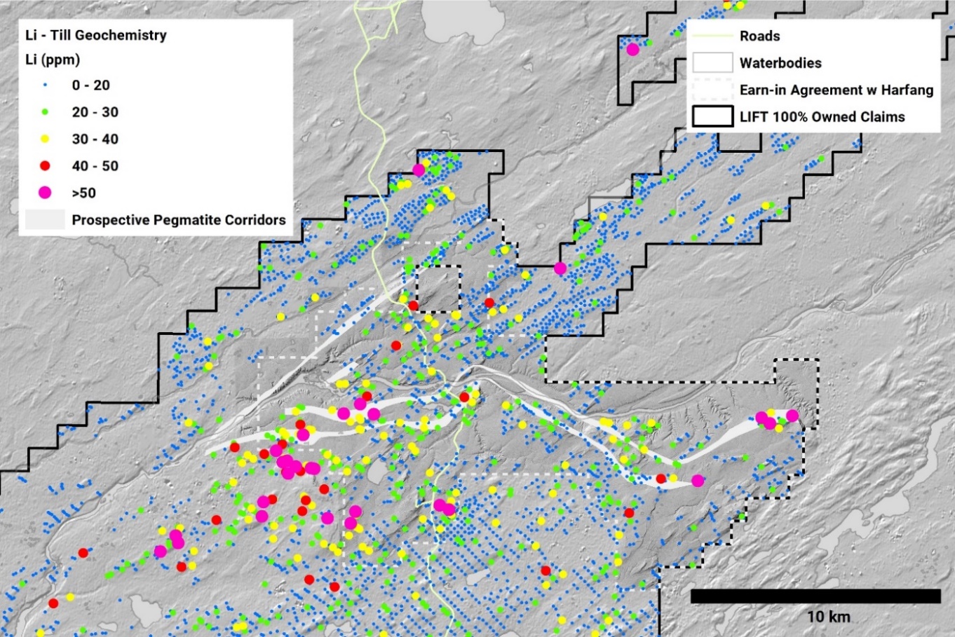
Figure 2 – Lithium values in till geochemistry samples at the Pontax Project. High Li values in till geochemistry occur proximal to fractionated pegmatites mapped in outcrop.
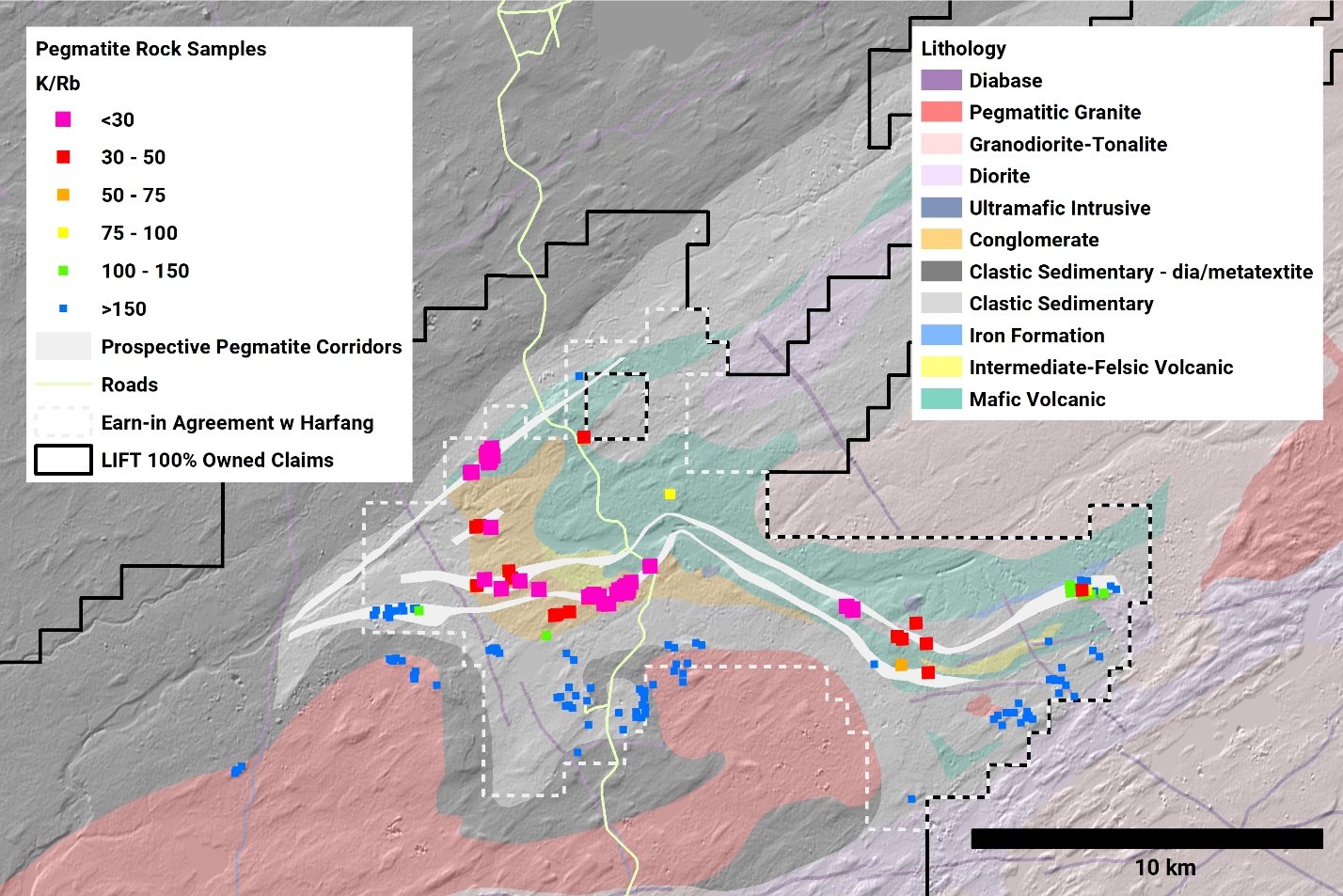
Figure 3 – K/Rb ratios from outcropping pegmatite samples in the Pontax area. K/Rb values define a ~25 kilometer trend which follows the folded contact between mafic volcanic rocks and clastic sedimentary rocks.
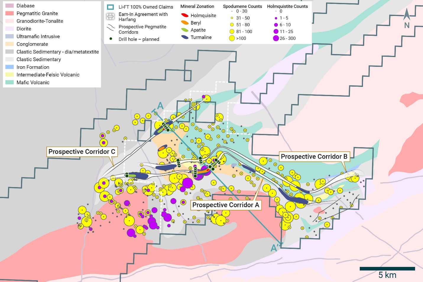
Figure 4 – Spodumene and Holmquistite Zonation map illustrating counts across the Pontax Project.
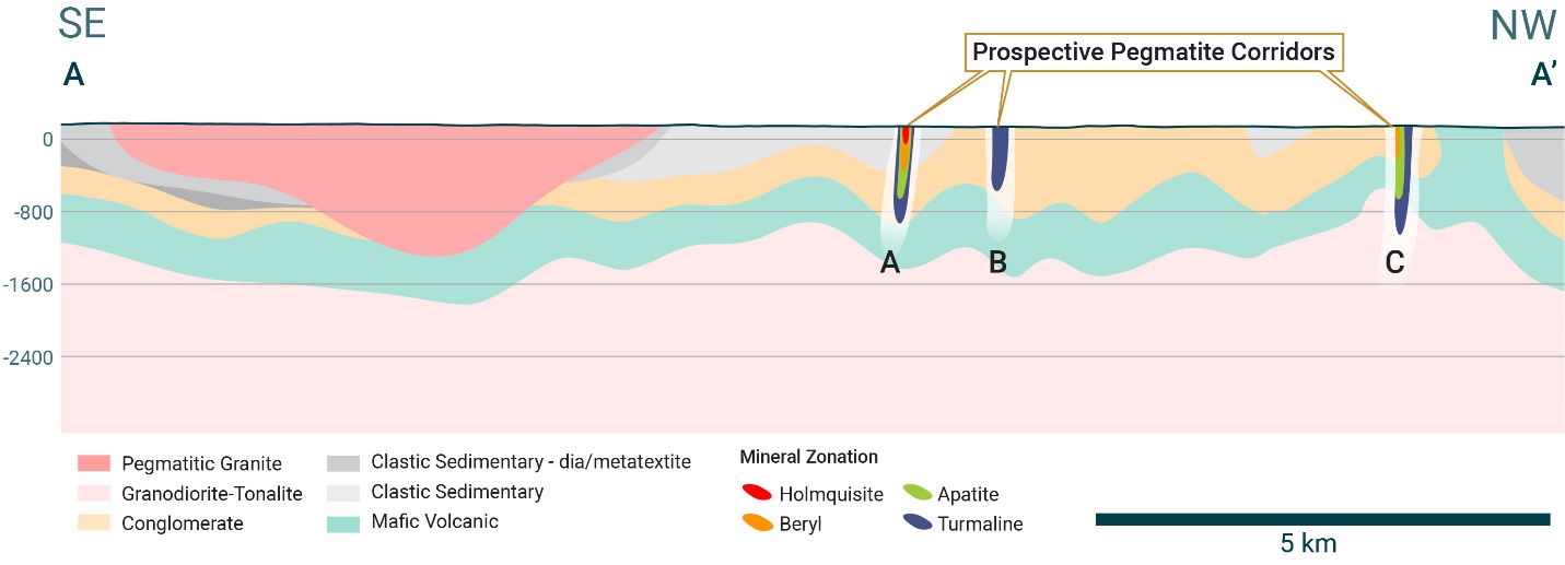
Figure 5 – Mineral Zonation and structural trends map with Drill fence location.